What Will Flooding Mean for Boardman Recreation, River Health?
By Beth Milligan | May 22, 2026
Local impacts from the April floods have been mostly felt so far in property damage and road closures, with damage estimates now totaling $21.2 million countywide. However, the flooding is also likely to have significant recreational and environmental impacts – some of which are just beginning to be understood.
A tremendous amount of debris entered the Boardman watershed during the flooding. That includes the collapsed Beitner bridge as well as chemicals, sewage, trash, plastic, lawn furniture, gas cans, and other detritus swept away from properties. Heather Smith of The Watershed Center Grand Traverse Bay previously noted that “you can’t track down who’s responsible” for debris in most cases, leaving it up to the community at large to handle cleanup.
Partners including the City of Traverse City, FishPass, and the Great Lakes Fishery Commission are organizing one of the first major river cleanups today (Friday) from 10am to 2pm in downtown Traverse City. The public is invited to meet at Rotary Square, where “cleanup supplies including trash bags and gloves will be available,” according to the city’s Bay Brief. “Volunteers may clean along the Lower Boardman/Ottaway River corridor from FishPass to the river mouth at West Grand Traverse Bay at their own pace throughout the event.”
The Beitner bridge site will also be cleaned up over the next few weeks, with the Grand Traverse County Road Commission (GTCRC) approving a contract Tuesday for the removal of the collapsed culverts. GTCRC Manager Dan Watkins said the goal is to make the site safe for river users as soon as possible. However, with the bridge replacement looming – construction could start this summer – it’s unclear whether the Beitner river landing and parking lot next to the bridge will be available this summer. The lot is inaccessible now because of road closures leading up to the collapsed culverts; the bridge construction zone could then prevent access once work begins.
It’s also not clear whether river users will even be allowed to go through that stretch once bridge work is underway, according to both Watkins and County Director of Parks and Facilities John Chase. “If we can get people to or past the Beitner space, we will do that – but life safety has to be the number one thing right now,” says Chase. Any closures required by bridge construction will be determined by the Road Commission, he says.
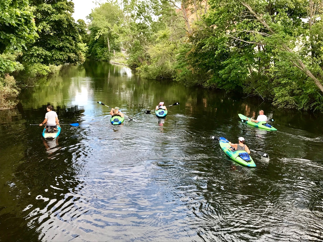
That’s just one of several impacts river users could see this summer. The Grand Traverse Conservation District (GTCD) provided The Ticker with a detailed update on the parkland and public access sites it manages. Boardman River access is currently open from Forks Campground to Scheck's Campground. Scheck's Campground to Brown Bridge Canoe Landing is also open. However, Brown Bridge to Beitner – including the popular Shumsky Road launch – is closed until further notice. Jack’s Landing to Boardman Valley Nature Preserve is navigable and accessible. GTCD cautions that while fallen trees have been cleared out, higher spring flows are still in effect and new obstructions are always possible.
In the Natural Education Reserve, the connecting trail between Jack's Landing and Beaver Pond trailhead is closed, as are all trails south of Cass Road. Those include the Boardman-Ottaway River Trail and Oleson Bridge (with the exception of Lone Pine Trailhead and mile markers 16 and 17). Chase says Oleson Bridge was a “casualty” of the flooding and will have to be replaced, with the Oleson trailhead and parking lot also closed. Keystone Rapids Trailhead is also closed, though everything north of Cass is open, Chase says.
At the Brown Bridge Quiet Area, the Grasshopper Creek Footbridge remains closed. All other trails are open and accessible. There are some other positives to report in terms of accessibility: The new Ottaway Crossing Footbridge, a 160-foot pedestrian bridge that spans the former Sabin Dam site, officially opens to the public on June 9. Chase also says Medalie Park and Logan’s Landing are in “great shape” post-flooding, with the county recently repaving the parking lot.
Kayak, Bike & Brew Manager Anthony Ruggirello has 13 years of experience overseeing tours on the river. He says this winter’s weather and the heavy floods mean the Boardman is “colder, deeper, and muddier” than usual. “It is a lot murkier now, not clear to see the bottom like usual, but I anticipate that will dissipate throughout the summer and hopefully be back to clear blue by July,” he says. The river is also higher – he estimates 16 inches higher in one landing spot – but believes that could come down by mid-summer. “It is slowly heating up, but be aware of water conditions when going out,” he says. Ruggirello adds he’s seen more floater logs, branches, and sediment than usual, but “nothing that prohibits the use of the lake or river.”
The long-term impacts to the Boardman’s appearance and health are still an open question. “I think it has a new normal, but we don’t know yet fully know what that’s going to be,” says Watershed Center Executive Director Christine Crissman. “Sediment is probably going to be the biggest issue.” While river temperature and flow will likely rebound, sediment buildup could impact the navigability of certain Boardman stretches and disrupt habitat and invertebrate populations. Those trends will likely take years to fully measure, Crissman says. While some sediment will eventually move through the system, other stretches – like between Sabin and the South YMCA – could be clogged for some time.
The Watershed Center is one of several groups in the Boardman-Ottaway River Network, which worked on the dam removal project along the river and now addresses short and long-term watershed issues. That group is working to inventory the river and prioritize where restoration efforts should be directed. The sediment runoff means shoreline was destabilized in many spots, Crissman says, creating significant erosion issues. As with the dams, a key part of the group’s work will be determining where human intervention is helpful – where debris removal, habitat restoration, or even dredging can speed along the river’s progress – and where it’s best “to let the river heal itself,” Crissman says.
That discussion also includes where rebuilding should occur – or not. Though some residents have blamed the dam removals for the April flooding impacts, Crissman says the dams had been aging and at capacity and would likely have failed. Their presence could have caused flooding behind the dams from backfilling or else a wall of water during a failure that could have resulted in even more devastation, she says. However, it’s true that the Boardman has a natural floodplain in which a lot of human infrastructure – from roads to buildings to trails – has been built, she notes.
“As people start to rebuild, how do we keep infrastructure out of that floodplain?” Crissman says. “There are a lot of things people are used to that are going to be very different with the Boardman now. How do we pivot for that new normal?”
Comment
Date Set For TC Central Track Dedication
Read More >>Opioid Spending Tops County Agenda
Read More >>TCBN: Private Equity Making Noise in Northern Michigan
Read More >>City Ready to Adopt New Parks Plan
Read More >>


What To Know About This Year's Cherry Festival Air Show
Read More >>Valarie Handy Named New Deputy City Manager
Read More >>Road Projects on Deck: Work to Start Soon on Franke, East Silver Lake, Skegemog Point
Read More >>Dennos Museum Center Gets a New Look and New Exhibits
Read More >>Hilton Tapestry Coming to Front Street; More Downtown News
Read More >>Allegiant Cuts TVC Fort Lauderdale Flights
Read More >>